As I said in the previous Blog Post, Maralinga was a dark-tourism highlight of my recent long trip to Australia, so much so that it deserves a separate longer post of its own. So here we go:
I’ll keep the historical background to a minimum here, as this post is more a tour report and photo essay (if you’re only interested in those images scroll straight down). More details will come in the Maralinga chapter for my main website when I get round to composing it – in the meantime the rather substantial Wikipedia entries for Maralinga and the tests conducted there can fill the gap for those who are after more detailed info straight away (external links).
The basics: Britain already had a research programme for developing nuclear weapons during WWII but that was merged with the Manhattan Project that culminated in the Trinity test and the subsequent bombing of Hiroshima and Nagasaki. But after the war, the USA withheld information for security reasons and stopped sharing such sensitive data with the UK. So Britain relaunched its own nuclear programme.
When it came to testing the British-designed nuclear weapons, Britain’s preferred location for conducting tests of such devices would have been the NTS, but the Americans initially didn’t allow the UK to use their mainland nuclear test site either. In the UK itself, a generally too densely populated land, no suitable sites existed (although apparently a place near Wick in northern Scotland was considered at one point). And so the UK turned to Australia, which of course had been part of the British Empire and subsequently the Commonwealth. The Australian government under the very pro-British then prime minister Robert Menzies did indeed grant the Brits permission to use a few Australian sites for their nuclear testing. As usual at the time there was little consideration for the traditional Aboriginal inhabitants, who were simply displaced.
The first test site was on the Montebello Islands off the coast of Western Australia, where a few tests were conducted in the early 1950s. Then a remote site in the Outback of South Australia called Emu Field was selected for further tests, and two detonations took place there in October 1953. Yet the site was deemed far from ideal, due to its remoteness, lack of water and frequent adverse weather (including sandstorms). So the Maralinga site, some 150km south of Emu Field was chosen.
Here two series of nuclear tests took place in 1956 and 1957, with a total of seven major detonations (of between 1 and 27 kilotons in yield) followed by countless “minor” (subcritical) tests that continued well into the 1960s. It’s actually those “minor” tests that were responsible for most of the subsequent radioactive contamination of the ground, mostly in the form of dispersed plutonium (which has a half-life of 24,000 years).
The Maralinga test site was closed in the late 1960s, a) because the attitude towards the British nuclear tests in Australia had changed markedly towards the negative, and b) because the 1963 Partial Nuclear Test Ban Treaty prohibited further atmospheric tests, and Maralinga was unsuitable for underground tests. So the site became redundant.
A first clean-up operation in the late 1960s proved seriously insufficient; so in the late 1990s a more concerted effort was undertaken in which large amounts of topsoil and irradiated equipment were buried in deep pits. After that the area was deemed safe enough to enter and it was officially handed back to the Aboriginal people from whom the land had been taken. The areas around the actual test spots remain unsuitable for inhabitation though, but short visits are possible without significant risks (as usual with radiation, risk assessment is a function of radiation level, distance from the source, and, most crucially, length of exposure). As stated on the tour operator’s website: during a single day at Maralinga you receive a dose that is equivalent to what you get through natural background radiation elsewhere in five to ten days. So that’s a very well calculable risk. In Maralinga Village, where visitors stay, the radiation level is actually well below average, so that’s perfectly safe.
And with that I’ll turn to the tour that I went on in August. There are two ways of visiting Maralinga, a) overland, with overnight camping or accommodation in Maralinga Village, and b) day return trips by small plane. Since driving all the way to Maralinga through the remote Outback is both demanding and time-consuming I opted for investing in a fly-in tour. For this, participants gathered before dawn at the small airport in Ceduna on the South Australian coast, and the return flight got us back to Ceduna just before sunset.
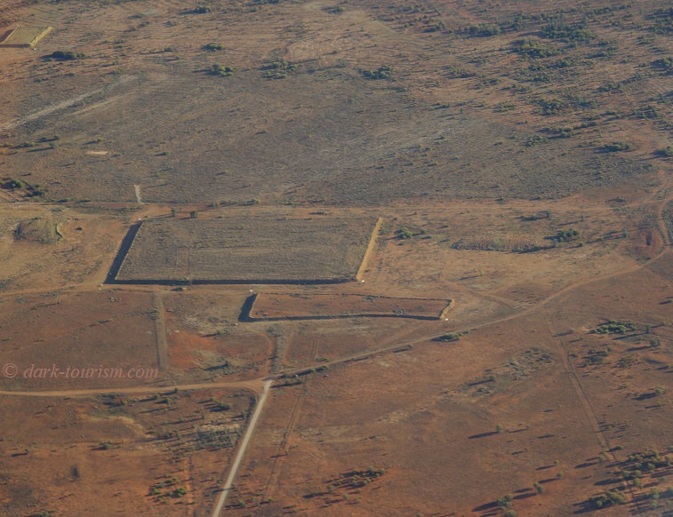
One advantage of the fly-in option is that it also includes a fly-over of parts of the test site. So we got a good bird’s-eye view of e.g. the “Taranaki” site, where the most powerful of the tests was conducted and where there are now large dumps of buried radioactive material, as seen in this photo:
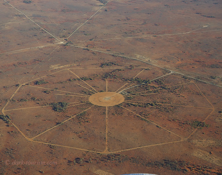
Visually the most stunning site we flew over was a test ground that had been prepared but in the end was never used, so you can still see the “spokes” radiating out from the intended ground zero; these were supposed to be used for assembly and monitoring/measuring equipment (same photo as the featured one at the top of this post):
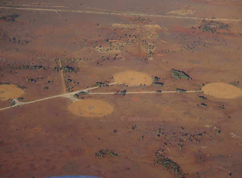
The plane also flew over a set of sites where those “minor” tests were conducted – and these were not included in the tour on the ground, so it was another bonus.
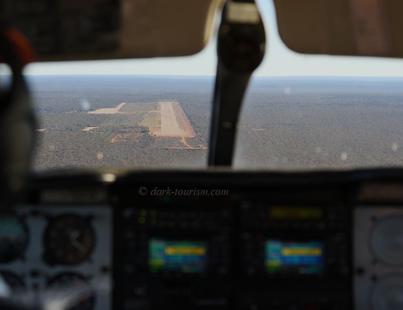
We then headed for the airstrip near Maralinga Village, seen here through the plane’s front windows:
After landing the pilot then handed us over to the on-the-ground guide and we joined the group of participants already there (who had driven in and were staying overnight in the village). In total we were a group of ca. 15 “nuclear tourists”. First we were given an intro talk by the guide inside the airfield’s “terminal” building.
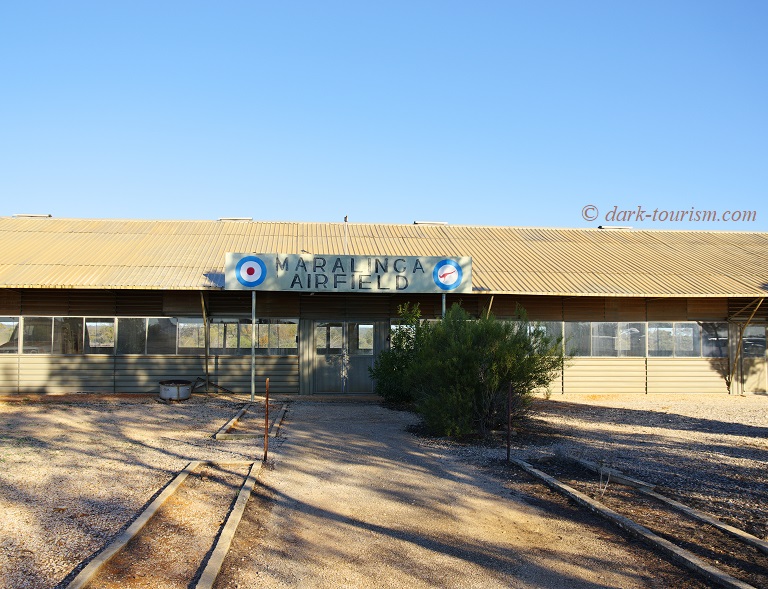
Following that we boarded the small tour bus. The first stop was at the end of the airfield. It’s much more than just an “airfield”, though. It’s actually a massive concrete and tarmac runway some 3000m long.
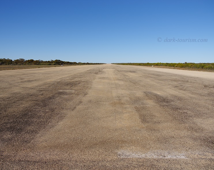
The runway is reinforced at both its end sections by several metres deep of first-grade concrete and could be used by the biggest military transport aircraft in existence. (Even the Antonov 225, which was destroyed in the early days of Russia’s military aggression against Ukraine, could have used this runway.) The Maralinga airfield was also standing in as a possible emergency landing site for the USA’s Space Shuttle. As the guide emphasized, this may not quite be the longest runway in the southern hemisphere, but it is definitely the strongest. What a remarkable engineering feat it is also shows in that it is still in near perfect condition, with no cracks or invading vegetation, even though it hasn’t seen any maintenance in decades.
It’s barely visible in the above photo, but the runway is very slightly tilted to one side (to the right from this vantage point). That is for helping the collection of rainwater to augment the site’s strained water supplies. And it was the rainwater collection reservoir that was the next stop on the tour:
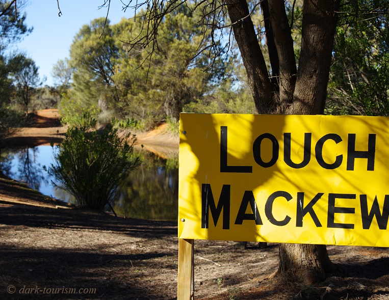
The site manager and tour guide reported that for a long time he thought the name given to the reservoir contained a misspelling of the word “Loch” (as in “Loch Ness”) … that is until a visitor from Northern Ireland pointed out that this is actually the spelling used in his country. (I guess that’s presuming that the fourth letter is supposed to be a <G>, though it looks too much like a <C> to me, in which case it would still be a misspelling.)
The tour bus then took us into the wide expanse of the “forward area”, as it was referred to, i.e. into the actual test site area.
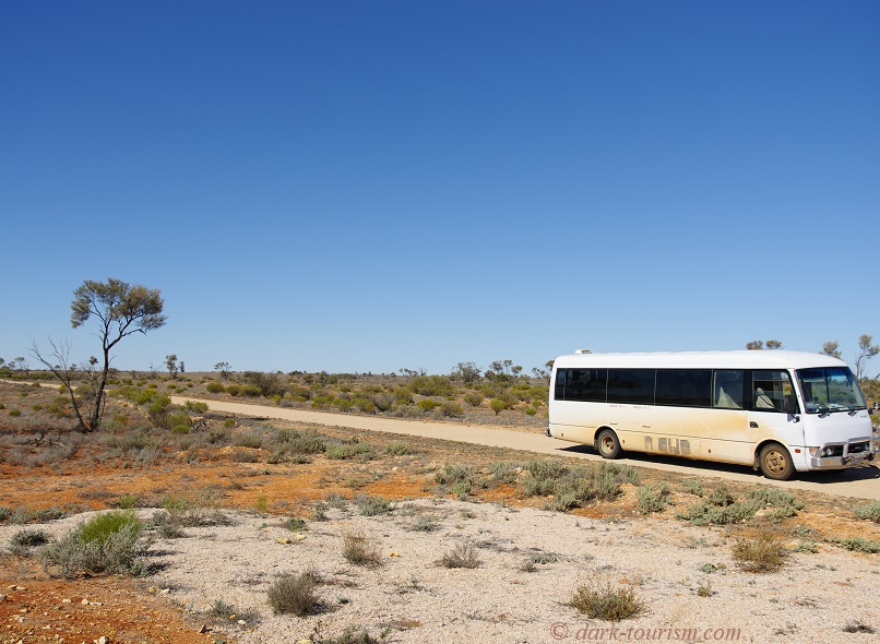
We passed some foundations of barracks where some of the military personal were accommodated during the test site’s active days, and stopped by an old well, which however only yielded non-potable salty water. The next stop was by an archaeological dig site of sorts. Here the current site management have been digging out an old bunker, an eerie steel-clad structure:
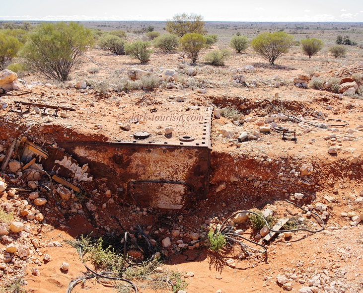
In this and other similar bunkers, young servicemen would have been sat during some of the tests – basically as human guinea pigs. Peeking in through that hole on the right-hand site of the bunker you could just about make out the wooden benches that they would have sat on.
Another stop on the tour was by the sign on the edge of the former “forward area”.
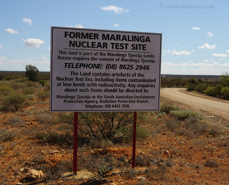
As the sign specifies, you need permission by the Maralinga Tjarutja Aboriginals’ administration authorities in order to enter the place. You have to submit the application online as part of the tour booking and the tour organizers then see to obtaining the permission on behalf of tour participants.
There are other signs that are directed at the Maralinga Tjarutja people, of which this is an example:
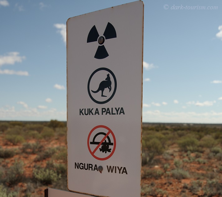
The upper part of the sign with the kangaroo says “meat OK” in the local Aboriginal language, the bottom line means “no camping”, that is to say they could hunt in the area but should not stay on the land. How they can be so sure that kangaroo meat from animals who do live on these lands is definitely OK for consumption I do not know – I guess they must have tested it. But it’s all rather irrelevant anyway, as the Maralinga Tjarutja who live in settlements outside the formerly restricted area have said they have no intention of returning to this land, which they consider spiritually destroyed (or something like that – I can’t quite remember the exact word used). But nobody thought to ask them before putting up hundreds of these signs positioned every 50m all around the Maralinga test site. They could have saved themselves the effort and costs had they only first enquired with the addressees of these signs.
More signs were erected at the burial pits where all the contaminated topsoil and irradiated equipment were dumped:
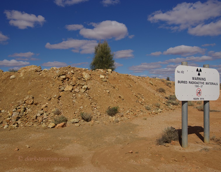
These burial sites are checked regularly and have so far been proven to be safe. No leakage or structural instabilities have been detected. But you certainly shouldn’t go digging things up here – or camp in the vicinity.
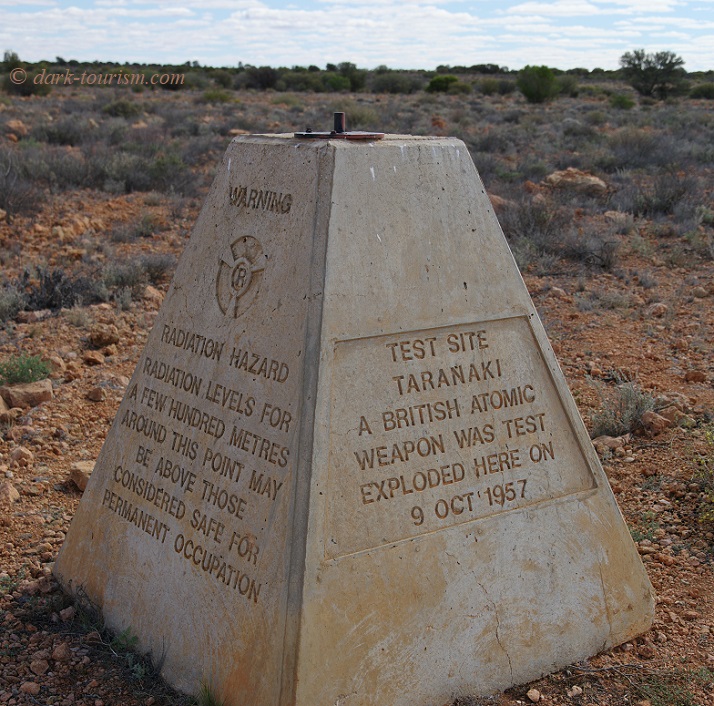
We then headed to the site of the ground zero of the test that was code-named “Taranaki”. It was the final and most powerful of all those conducted at Maralinga, at ca. 25-27 kilotons (that’s slightly more powerful than the Trinity and Nagasaki bombs were). The spot is now marked by this concrete pyramid:
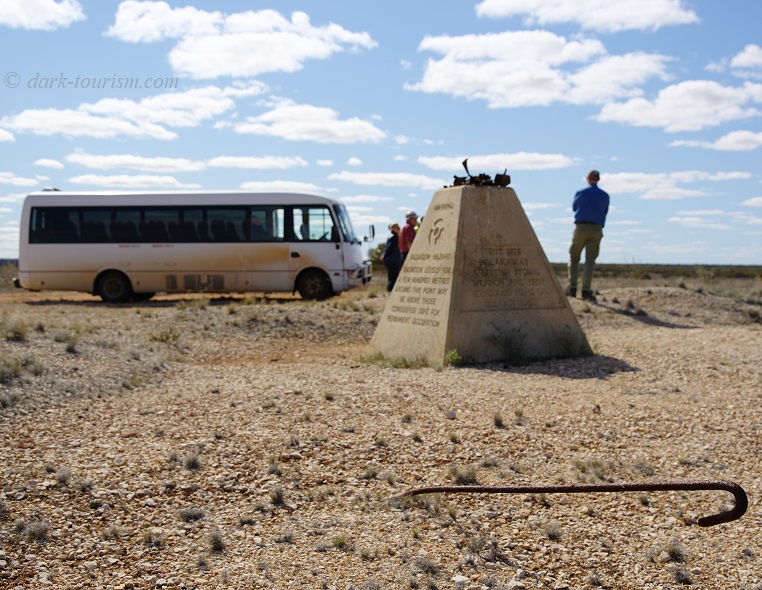
After that we drove on to the marker for the ground zero of the test that was code-named “Breakaway” (how these tests got their code names has always remained a mystery to me –
“Breakaway” and “One Tree” are amongst the most baffling). This was a test set-up much like Trinity, with the device placed atop a purpose-built tower (which then got vaporized in the fireball). The marker at ground zero is of exactly the same design as at “Taranaki”, with the same warning on one side:
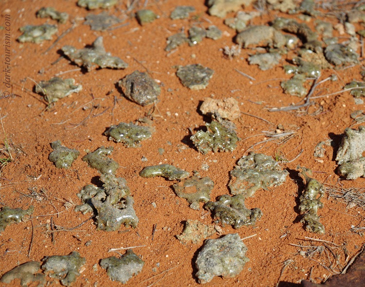
And just like at Trinity, “Breakaway” left behind a ground surface covered with molten sand converted into a green, glass-like substance: trinitite! Much of it was cleared away, but here at “Breakaway” quite a few bits are still to be found on the ground. Here’s a photo of a particularly rich patch:
Their radiation contamination has gone down so much that the pieces of trinitite are quite safe to handle. So you can pick a piece up and hold it against the sunlight to see its glass-like, semi-translucent nature:
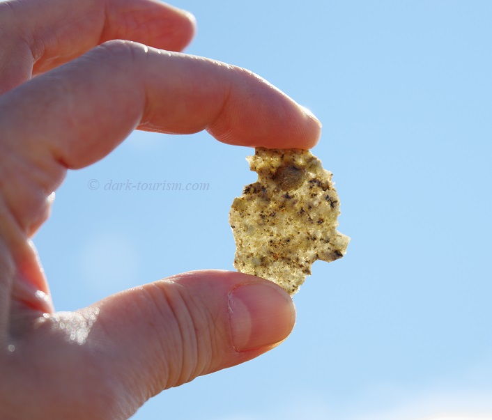
Our guide, who had picked up on the fact that I had been to Trinity, then asked me whether the trinitite found there was the same colour as that here. Indeed, I affirmed, it’s the same hue of green. He then added that the trinitite he had found at Emu Field was not green but black. I suppose it’ll have to do with the chemical composition of the affected soil.
Near the site was also a cluster of rusty metal boxes, allegedly for transporting photographic equipment used in the documentation of the test(s).
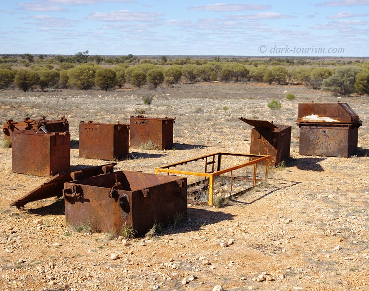
Why these boxes were left here and not buried together with all the other test equipment, I do not know. I can only presume that they were found not to be so irradiated that it was OK to just leave them in situ.
The third and final ground zero we visited on the tour was that of the test code-named “Marcoo”. It too has the same sort of concrete marker at the ground zero spot:
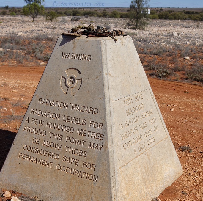
“Marcoo” was the second test of the first round and detonated on 4 October 1956. It was different from all the other tests in that the device was exploded right on the ground. Even though the yield was comparatively minor at 1.5 kilotons, it still ripped a giant crater into the ground – figures given vary from 10 to 30 metres deep and 50-60 metres in diameter. Some eight months after the test a local Aboriginal family was found camping inside the crater (some sources say next to it). They were immediately removed from the site and underwent decontamination measures. Still they suffered severe medical after-effects (including a mother giving birth to a stillborn baby).
The “Marcoo” crater was later filled in with highly irradiated material and sealed with layers of non-contaminated soil. So it’s no longer there to be seen. Yet it is still quite an eerie feeling standing at the site knowing what’s underfoot.
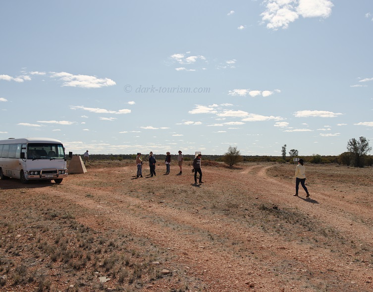
Our guide also pointed out the track in the distance which would eventually lead to the Emu Field nuclear test site, a good three hours’ drive away.
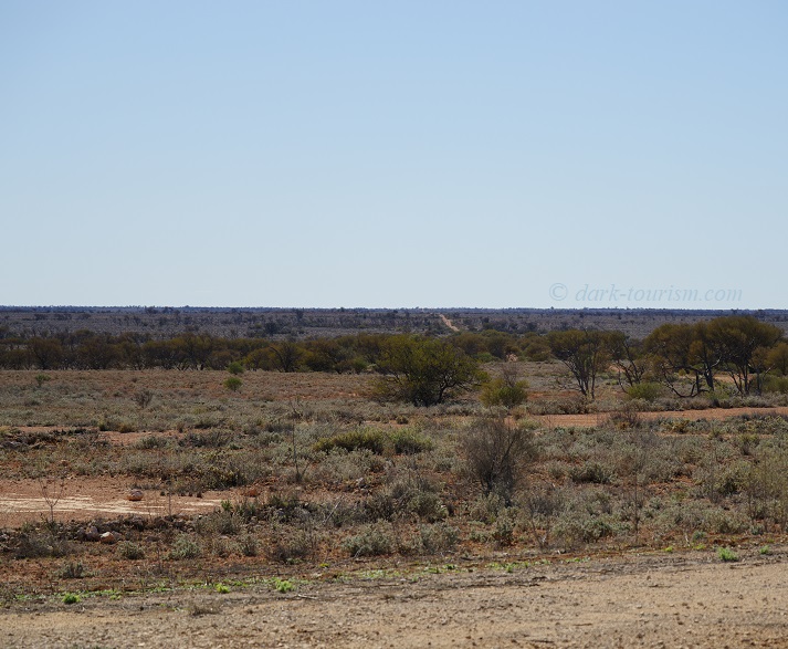
Emu Field is not part of the tour and could not be, as the track goes through a restricted military area administered by RAAF Woomera, from where a special separate permit would have to be obtained. Hence very few non-military people have ever gone there. Our Maralinga guide said, though, that they are working on ideas of possibly making Emu Field also accessible for determined nuclear tourists. So perhaps in the future it may become an option as well.
We then left the “forward area” and headed back to Maralinga Village. Here we were led into a small museum of sorts, with displays of old photos from the operational days of Maralinga as well as a jumble of accumulated test-site-related objects:
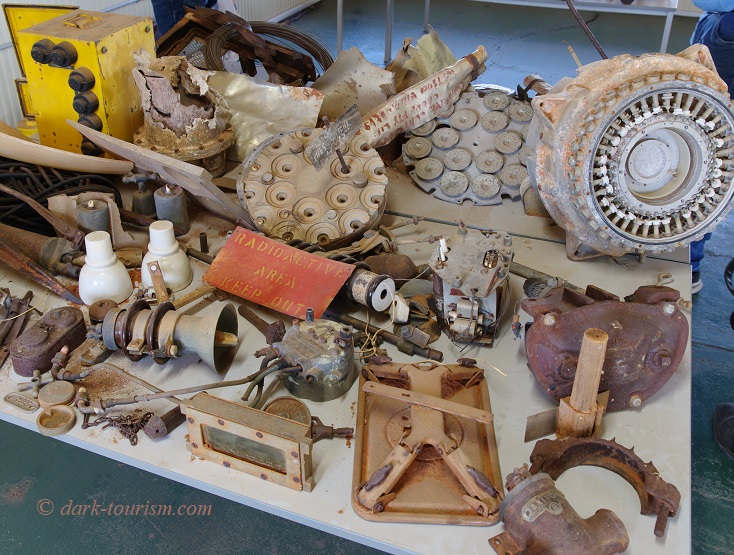
Some of these objects, especially those circular ones in the top right part of the frame, were apparently components of actual atomic bombs (obviously ones not used), so our guide explained.
Eventually those of us on the fly-in tour were transferred back to the airfield with our pilot. There we boarded the little twin-engined Cessna for the flight back to Ceduna. After take-off we got a final good bird’s-eye view of Maralinga Village and the airfield behind it:
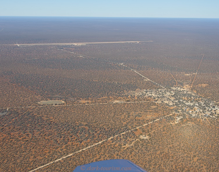
That concludes this Maralinga post and photo essay. As I said, for me it was a top highlight of my Australia trip – but then again I have a penchant for the ‘nuclear tourism’ subcategory of dark tourism. Maralinga was the third former nuclear test site that I’ve visited, after the STS in Kazakhstan in 2011 and Trinity in the USA in 2012. The three visits were of very different natures. The STS was wild, with just four of us (a guide, a driver, my wife and myself) simply driving into the then unfenced and unguarded area and poking around at the Polygon ground zero and the measuring towers still in place there. Trinity on one of its twice-a-year open days was, in stark contrast, bordering on being a mass tourism event with hundreds of cars filling the parking areas provided, crowds of people at ground zero and even souvenir and BBQ stalls on the edge of the ground zero area. Maralinga in turn was the most in-depth and by far the most informative of the three visits. If you’re like me and have an interest in the Cold War and nuclear history I can only highly recommend it. For others it may seem like quite an effort for not all that much to see (and the fly-in tour comes with a significant price tag). Indeed without that special interest and a desire to feel the unique and eerie place authenticity of such a site, it would not make much sense embarking on this tour. But I found it fabulously exciting and enlightening.
Another top location to visit would be the Nevada Test Site (NTS, officially now renamed Nevada National Security Site, NNSS) in the USA, but the once-a-month public tours are restricted to US citizens or permanent residents in the US. So I’d be excluded. That leaves the various nuclear test sites in the Pacific as well as the former French test sites in Algeria, but these are also extremely difficult to visit, if possible at all. In contrast, the by far most touristy and easy to visit locations of nuclear detonations are, ironically, Hiroshima and Nagasaki, the only targets of atomic bombs ever used for real (“in anger” as the military lingo goes).

8 responses
my father was at Maralinga for the 1957 tes and he was there in 1963 foe Anteler test he died in 1969 from radiation contamination.
oh, thanks for the contribution. What a personal connection! In what capacity was your father at those tests? As a soldier? And did he die directly of radioation or rather of radiation-induced illness such as cancer?
That is very sad your dad died from radioactive contamination Eric. I’ve worked in Oak Valley in a health program – it’s a lovely community it’s and amazing Country.
very interesting article many thanks. My Father also served with the Australian army medical corp and was stationed at Maralinga during the atomic tests. I remember him telling of when they left the site the doors were just closed in a fully operational hospital. he died in 1997 with illness contributed to radiation exposure at maralinga and Japan as part of the occupational forces.
thanks for your comment – yours is the second such case that has been brought to me. This is clearly quite some dark legacy. Did your father serve in Japan in Hiroshima and/or Nagasaki right after WWII? It’s probably more likely, though, that the radiation exposure that caused the illness would have come from Maralinga …
Interesting blog with good pics
Taranaki was of course the site of the Vixon minor trials which did indeed course most of the Maralinga contamination. The pits on that site( some 20 odd )where the subject of a novel system of in situ vitrification to melt the contents into a solid mass.
I conducted the successful geochemical design for the vitrification project at Maralinga to assure the vitrified product would achieve acceptable chemical durability. The circular objects shown in the photo are actual parts from an atomic bomb that was partially damaged during a “safety test”. Safety tests involving blowing up nuclear bombs in unique ways were conducted to determine the safety of the device to avoid an accidental full yield detonation (for example if a plane crashed while carrying a device). The safety tests are responsible for a vast amount of Pu contamination since the Pu is pyrophoric, burned upon contact with oxygen, and was widely spread. I was there for the explosion at Pit #17 in 1999. Based on my forensic assessment, the explosion was caused by buried explosives that were originally used to loosen the ground for excavation of the burial pits back in the 50’s. When the heat from the in-situ vitrification encountered a dud left behind, it detonated. The explosion destroyed equipment and resulted in an eruption of radioactive lava. Because extensive safety procedures were practiced, nobody was hurt or killed. The government did not like this assessment because they had warranted in writing that nothing in the pits would blow up. It was an interesting time.
wow! Interesting indeed! Thanks for the comment.